The New Situational Awareness for Emergency Responders
Today, first responders are demanding that if data are available, municipalities must disseminate that information for the health and safety of employees and the public.
- By Margaret Moran
- Dec 01, 2012
In the past, emergency responders have been satisfied with receiving only essential data for a call, including the type of situation and the location to which they were responding. Any other information, such as a map to reference where they were going, was considered a lucky break.
Advancements in public safety technology systems are continuously evolving to provide better information and enhanced decision-making. These enhancements include automated communications between dispatchers/responders and response mechanisms that improve critical data access. These advancements serve to better protect emergency response personnel and the public that relies upon them.
Two major occurrences in the technology world have changed the requirements for receiving and using emergency response data: the launch of wireless networks and the development of digital mapping. During the decade that followed, vendors pushed the envelope with these technologies beyond what the industry had considered to be possible.
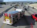
The first wave of upgrades provided emergency responders with real-time data systems for field use, in the form of mobile data computers. Digital maps from the dispatch center would then plot out the calls and provide the command center with better situational awareness. Dispatchers were not able to send the full array of data to the emergency responders, but the capacity for collecting important data was getting stronger.
Once emergency response providers began using Automatic Vehicle Location (AVL) and cellphones, response times were significantly reduced. This advancement provided responders with access to a "true point" for the location in which they were needed. The responders are then able to leverage this intelligence against the location of available vehicles, allowing the closest available unit to respond. These capabilities are now recognized as operational and procedural milestones for the emergency response industry.
Many of these technological advancements first surfaced to the public on television programs such as Fox's serial drama "24" and CBS's "NCIS LA." The shows began making use of satellite mapping systems and tracking devices, further demonstrating how these advancements are in place to ensure public safety. The media exposure demonstrates how the analysis and dissemination of comprehensive data is relevant to public safety practices. The technology empowers the emergency response community to make capable and informed decisions when responding to calls and serving citizens.
Emergency Response, Then and Now
Let's go back in time to a real emergency call that happened in 1995 in a city in Florida, though the call could have taken place anywhere.
A call comes into the 911 center for a woman who has fallen or passed out. The call-taker asks the caller for the address where the incident occurred and verifies it with the 911 screen. The address is then typed into the computer system, along with the nature of the call and the additional information. The caller states she got out of her car and walked into the store, where the woman was lying on the floor. She is not sure whether she passed out or fell. The woman was breathing but seemed confused. The caller walked next door to dial 911.
The dispatcher sends the closest fire/EMS unit from a station about 3 miles away from where he believes the woman to be and tells the caller help is on the way. En route, the EMS unit encounters a traffic light that is out. Traffic has backed up, and the unit notifies dispatch the light is out and they will be delayed due to traffic. The unit arrives at the location about four minutes later and tells dispatch there is a large pothole in the street at the driveway. They ask dispatch to notify public works. About one minute later, the unit informs dispatch there are two people down and they will advise if they need another unit.
What happens next is not expected: The 911 phones start ringing off the hook. Not only are two women down, but also two firefighters are lying on the floor inside the store. The call-taker asks, "Have they been shot?" The caller answers, "No, they just fell down." The call-taker dispatches a full fire station response, notifies the commander, and asks the police department to respond. Upon arrival, the commander looks at the computer-printed new business sign in the window and declares the store a hazmat incident. Firefighters don breathing apparatus and carry the four victims out of the store. The two non-EMS victims are transported to a hospital by ambulance, while the firefighters are taken separately to another facility. Fortunately, all four are released from hospitals later that day.
What went wrong? Could at least part of this incident have been prevented?
It all comes down to an issue of "situational awareness." Today, first responders are demanding that if data are available, municipalities must disseminate that information for the health and safety of employees and the public. Technology is available to support managing the data, and it should be retrievable in real time for all municipal workers, not just for emergency responders.
Let's revisit what happened in the incident and replay what would happen in a state-of-the-art community today. The business was located in a new strip center, and the computer-printed sign in the window read "Pete's One Hour Photo." A new employee who had not been sufficiently trained had improperly disposed of a film-developing chemical, which caused an odorless, toxic vapor to be emitted, causing four people to be hospitalized.
Departments that may have had data that could have been helpful in this scenario include these:
- Occupational license: Knowledge of the name of the business and the ability to alert EMS personnel to the information
- Permitting: Intelligence of any existing special permits for the store
- Building Inspection: Details on chemical containers and required hazmat sheets for each chemical on premises
- Fire Inspection: Records of notifications about chemicals being on site
- Public Works: Previous reports about the pothole in the street
- County traffic control: Previous reports of the traffic light's being out
The scenario would have been different had it occurred in 2012 in a progressive city:
The enhanced 911 system rings, and as the call-taker answers the phone, the data are automatically sent to the computer-aided dispatch (CAD) system. The map instantly centers on the call location and shows not only the recent in-bound call, but all open calls and available units in the surrounding area. While the call-taker is verifying the address and hearing about the problem, the CAD system is querying the loosely coupled data elements from all of the other systems connected by the address the caller gives and parcel data, regardless whether all systems are from the same vendor's software.
Using this type of data integration presents real-time, up-to-the minute data to the 911 dispatch and the responding crews. The technology works like a Facebook side ribbon or a Google search that looks for patterns or links. As the information is being presented, the dispatcher continues with the call process, now having the system recommend not only the closest unit but also the correct type of emergency response unit using real-time AVL data.
As the route is plotted, the system once again uses real-time situational awareness capabilities and checks live traffic updates to re-route the units to circumvent the broken traffic light, while displaying the public works information along with a photo of the pothole that was sent into the 311 system by a citizen using his smartphone. When the units are en route, the hazmat data sheets are flagged, and the type of business and assigned violations are known. Only one victim is on site because the call-taker told the caller to stay out of the business until help arrived.
The process is not as complex as it sounds; actually it's highly intuitive and cost effective. The key component is that each department must input the data it receives within a system that can be accessed using other public safety systems. This ensures data continuity and promotes wider access to information that is critical for performing emergency services. Data do not need to be sent from department to department, meaning no time is lost waiting for systems to be updated. The time saved when sending critical data could, in turn, help save the lives of citizens or emergency responders.
This article originally appeared in the December 2012 issue of Occupational Health & Safety.